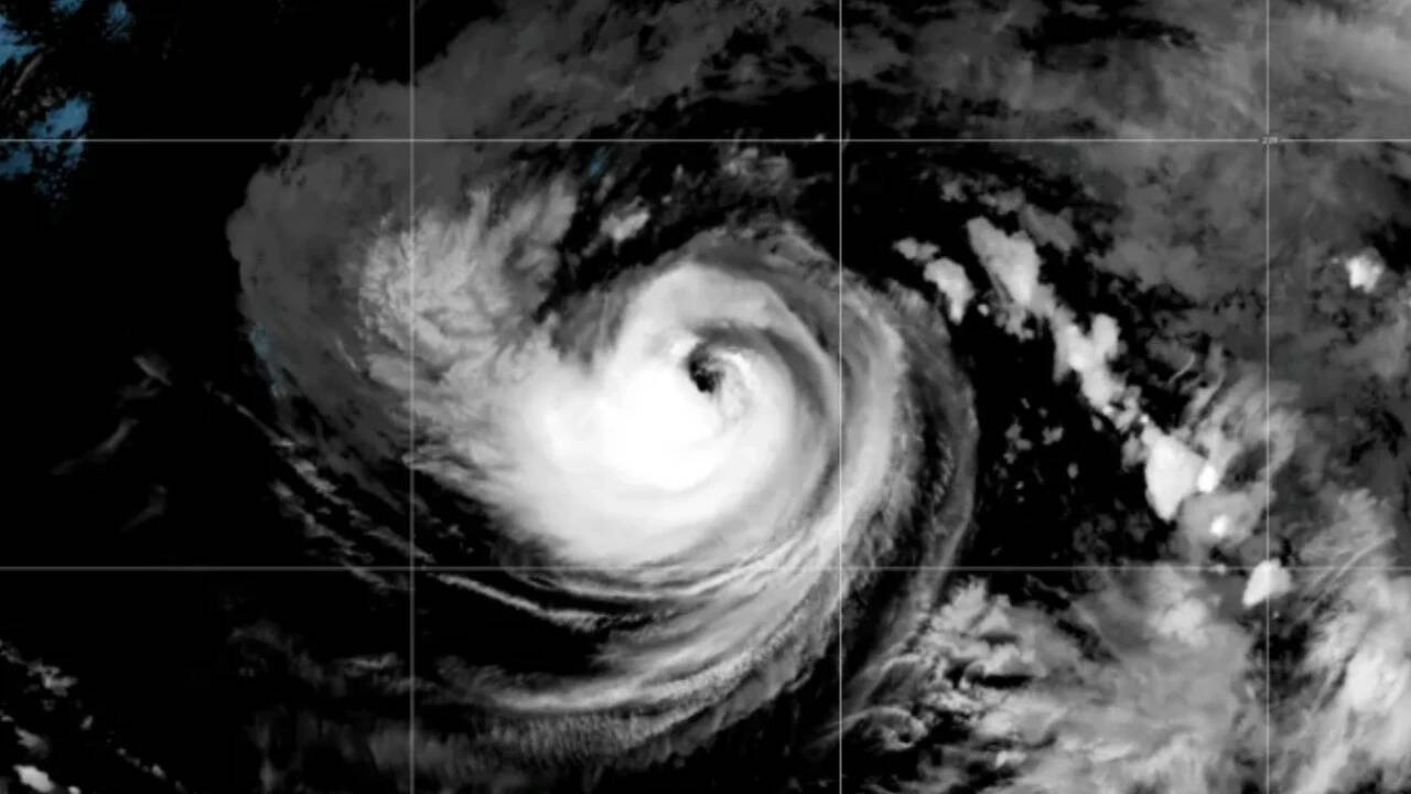
When the National Hurricane Center flags a 90 percent genesis probability for an offshore low-pressure system, mainstream coverage frequently collapses complex meteorological mechanics into panicked binaries. The standard narrative fixates on the 90 percent statistic, treating development probability as an equivalent measure of direct regional impact. This interpretation fundamentally misreads the physical barriers that dictate Eastern Pacific storm trajectories. Evaluating the actual exposure of Southern California requires parsing the thermodynamic engine of the open ocean, the steering currents of the mid-troposphere, and the stark thermal constraints imposed by the California Current.
The genesis of a tropical disturbance relies on a strict thermodynamic cost function. Surface water temperatures must consistently exceed 26.5 degrees Celsius down to a sufficient depth to prevent upwelling of cold water from weakening the core convection. Simultaneously, vertical wind shear—the change in wind speed and direction with height—must remain low to prevent the nascent vortex from tilting and shedding its heat engine. When an offshore system achieves a high probability rating for depression formation, it merely confirms that localized sea surface temperatures and ambient moisture have satisfied these baseline activation energy requirements.
Translating open-ocean cyclogenesis into a regional threat vector demands analyzing the steering currents managed by the subtropical ridge, commonly known as the Bermuda-Azores high in the Atlantic or its Pacific equivalent. Tropical systems possess minimal internal steering velocity; they act as passive particles embedded within larger environmental flow fields. The position and amplitude of the persistent ridge dictate whether a system recurves harmlessly into the open ocean, tracks parallel to the Baja California Peninsula, or encounters a trough that pulls it inland.
The primary structural obstacle protecting Southern California from direct tropical storm landfalls is the thermal sink of the California Current. As systems track north-northwestward along the Baja coast, they invariably encounter progressively cooler ocean waters. This transition starves the tropical cyclone of its primary energy source: latent heat flux from the ocean surface. Without continuous thermal replenishment, surface friction and entrainment of dry ambient air rapidly erode the symmetric core of convection. Consequently, very few systems maintain tropical storm status upon reaching the latitude of the international border.
Historical precedent underscores the strictness of these physical limitations. While moisture plumes from decaying tropical systems regularly breach the southwestern United States—producing localized flash flooding and heavy orographic rainfall—actual tropical storm landfalls north of the border remain statistical anomalies. The most notable analog, the 1939 Long Beach tropical storm, required an anomalous configuration of upper-level steering troughs that forced an atypical trajectory across cold water boundaries before landfall. Modern forecasting models evaluate these trajectory probabilities by running ensemble predictions, testing hundreds of slight variations in initial conditions to map the distribution of potential steering outcomes.
Public risk communication often fails to distinguish between primary wind hazards and secondary hydrological impacts. Even when a system undergoes extratropical transition or dissipates into an open wave of low pressure, its remnant moisture plume interacts with local topography. Southern California features complex coastal mountain ranges that force maritime air masses upward, inducing rapid adiabatic cooling and high-rate precipitation. The primary damage function in these scenarios shifts entirely from sustained cyclonic winds to debris flows, urban flash flooding, and compromised drainage infrastructure in burn scars or saturated watersheds.
Emergency management frameworks must therefore decouple the initial genesis percentage from local mitigation strategies. A high probability of tropical depression formation off the coast of southwestern Mexico initiates a multi-day tracking window, but operational readiness should be dictated by moisture transport vectors and precipitable water anomalies rather than storm intensity labels. Tracking the integrated water vapor transport allows meteorologists to quantify the volume of moisture headed toward specific coastal zones long before a center of circulation is defined.
Effective preparation requires monitoring real-time upper-air soundings and satellite-derived microwave imagery rather than relying on static headline metrics. Evaluate steering flow anomalies at the 500-millibar pressure level to determine if mid-latitude troughs will capture the remnant moisture or shunt it safely out to sea. Maintain continuous situational awareness through official National Hurricane Center advisories to separate localized rainfall projections from generalized coastal threat narratives.


