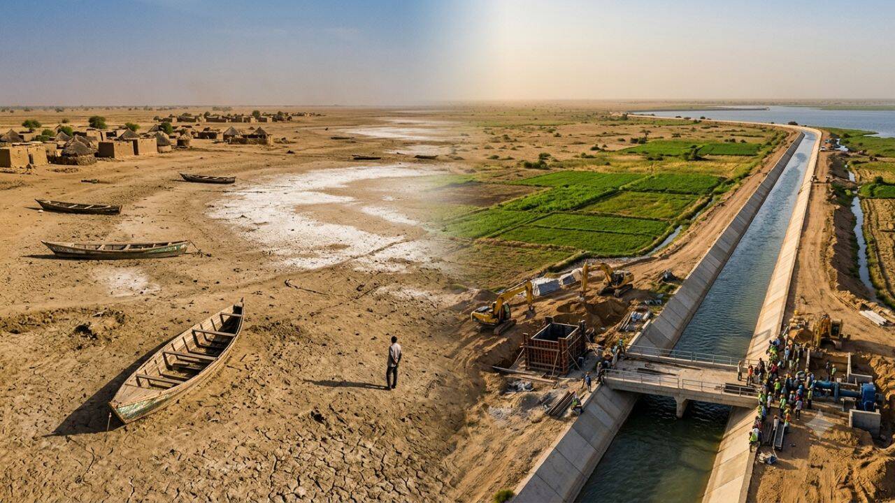
Between 1963 and 2001, Lake Chad lost more than 90 percent of its surface area, contracting from roughly 25,000 square kilometers to less than 2,500 square kilometers. This contraction is rarely a simple story of climate change; it is a structural failure of resource management, basin topology, and unregulated upstream abstractions. To offset this ecological collapse, the Lake Chad Basin Commission proposed an inter-basin water transfer scheme budgeted at $50 billion—the Transaqua project—designed to divert water from the Congo Basin thousands of kilometers north. Evaluating this crisis requires stripping away sentimental environmental rhetoric and examining the precise physical mechanisms, economic trade-offs, and geopolitical friction points that govern the Sahel's water security.
The Three Drivers of Hydrological Collapse
The shrinking of Lake Chad is driven by three distinct structural forces that compounded over four decades.
1. Precipitation Volatility and Sahelian Shifts
The primary inflow to Lake Chad depends on the Chari-Logone river system, which accounts for approximately 95 percent of the lake’s water supply. This river system relies entirely on the West African Monsoon. When the monsoon belt shifted south during the prolonged droughts of the 1970s and 1980s, annual rainfall across the catchments dropped by 20 to 30 percent. Because the lake rests in an extremely shallow endorheic basin with an average depth of just 1.5 to 4 meters, small drops in volumetric inflow produce massive reductions in surface area.
2. Upstream Irrigation Abstraction
Climatic factors explain only part of the contraction. Unplanned agricultural expansion along the Chari and Logone rivers removed massive volumes of water before reaching the lake basin. Large-scale irrigation projects built during the late 20th century diverted water into inefficient flood-irrigation channels. Evaporation losses in these open channels reach up to 40 percent prior to crop absorption, creating a structural deficit in downstream yield.
3. Basin Bathymetry and Evaporation Rates
The Lake Chad basin acts as a giant evaporating dish. High ambient temperatures in the Sahel drive annual potential evapotranspiration rates exceeding 2,000 millimeters per year. Once the lake split into two distinct northern and southern pools during the 1980s drought, the northern pool lost its continuous recharge from the Chari River. The sand barrier between the basins created a threshold effect: once water levels fell below 279 meters above sea level, inflow to the northern basin ceased entirely, causing rapid desiccation.
Anatomy of the $50 Billion Inter-Basin Transfer Mechanics
The Transaqua proposal represents one of the largest engineering projects ever conceived. The core objective is to move approximately 100 billion cubic meters of water per year from the Congo River basin to the Lake Chad basin.
The Civil Engineering Footprint
The project relies on a 2,400-kilometer canal running along the eastern rim of the Congo Basin in the Central African Republic. The canal is designed to intercept water from several right-bank tributaries of the Congo River, specifically the Ubangi River, and convey it via gravity to the Chari River watershed.
- Elevation Mapping: The transfer requires lifting or channeling water across the Congo-Chad drainage divide. Water must be elevated or directed through engineered cuts at the divide line near the CAR-Chad border.
- Hydroelectric Dual-Output: To offset pumping costs along sections where gravity flow is impossible, the design incorporates hydroelectric dams along the intercepted tributaries, generating power while controlling discharge rates.
- Navigation Channels: The proposed canal width exceeds 100 meters, intended to serve as a navigable transport corridor connecting Central Africa to Northern river ports.
Technical and Geopolitical Failure Modes
Placing a $50 billion engineering structure over fragile states introduces major operational risks. Four critical failure modes threaten the viability of the transfer.
1. Ecological Disruption in the Donor Basin
Diverting 5 to 10 percent of the Congo Basin's total discharge alters the hydrological regime of the Ubangi River. Lowering the water levels in the donor tributaries reduces downstream fish stocks, alters sediment transport dynamics, and threatens river navigation around Kinshasa and Bangui during low-flow seasons. The ecological cost is shifted from the Sahel to the Central African rainforest ecosystem.
2. Capital Efficiency and Opportunity Cost
At an estimated cost of $50 billion, the project requires capital expenditures that exceed the combined annual Gross Domestic Product of several participating countries. Funding this project via sovereign debt increases default risks across the region. Alternative investments in regional water efficiency deliver higher returns per dollar spent:
- Drip Irrigation Retrofits: Upgrading local agricultural systems to micro-irrigation requires under $3 billion and reduces river abstraction by over 30 percent.
- Groundwater Management: Mapping and tapping the deep non-renewable Nubian Sandstone Aquifer System offers immediate localized supply without multi-decade infrastructure delays.
3. Geopolitical Power Asymmetries
The project spans five sovereign states: Democratic Republic of Congo, Republic of Congo, Central African Republic, Cameroon, and Chad. Giving downstream states control over the primary water supply of upstream states creates severe geopolitical leverage imbalances. Hydro-hegemony issues arise if the donor country demands financial or political concessions under threat of reducing flow rates.
4. Security Vulnerabilities
The proposed canal route passes through active conflict zones in the Central African Republic and eastern Chad. Fixed infrastructure spanning thousands of kilometers in ungoverned spaces represents a high-risk target for non-state armed groups. Sabotage along a single section disrupts the entire recharge chain, rendering the asset vulnerable to continuous operational risk.
Strategic Alternatives for Regional Water Security
Restoring regional stability does not require a mega-engineering transfer. A localized, high-efficiency resource deployment strategy provides higher reliability at lower capital cost.
Phase 1: Local Water Productivity Enhancements
The immediate focus must target agricultural consumption efficiency. Replacing open-channel flood irrigation with subsurface drip networks reduces evaporative loss to under 5 percent. Imposing strict quotas on water abstraction along the Chari-Logone system guarantees a minimum base flow to the lake basin.
Phase 2: Watershed Sedimentation Control
Reforestation and soil stabilization along the Logone and Chari river banks prevent siltation. Excessive sediment accumulation reduces the riverbed depth, spreading water over broader, shallower areas and accelerating evaporation before the water enters the main lake basin.
Phase 3: Micro-Basin Storage Solutions
Building small-scale retention dams and localized aquifer recharge zones retains rainwater within the topsoil layer. Micro-scale rainwater harvesting reduces reliance on surface waters from Lake Chad, allowing the natural hydrologic system to achieve equilibrium without artificial, inter-basin intervention.
The long-term recovery of the Sahel hinges on managing demand within existing environmental limits rather than engineering high-risk supply additions across volatile international borders.