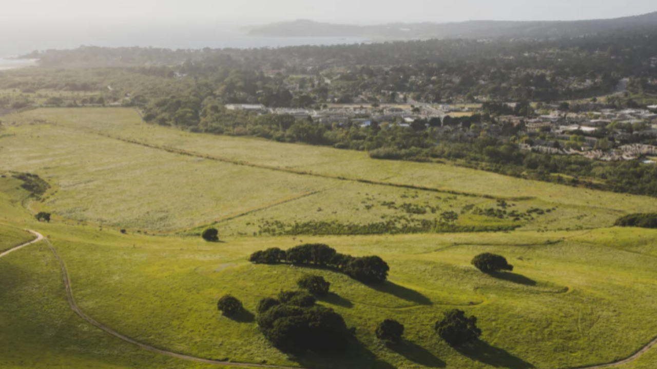
The Carmel River Free Project and its centerpiece Eastwoods ranch restoration carry a fifty-seven million dollar price tag, yet this heavy investment fails to guarantee complete flood safety for vulnerable residential pockets. Environmental engineering often sells a clean narrative. Water flows, concrete disappears, and nature reclaims its floodplain. Reality rarely cooperates with municipal press releases. Behind the glossy renderings of restored riparian corridors lies a complex web of hydrological compromises, bureaucratic hurdles, and persistent risks that homeowners living near the lower reaches of the river cannot afford to ignore.
For decades, the lower Carmel River basin has operated under a strained artificial baseline. Levees constrained a system that desperately needed room to expand, turning winter storm surges into high-velocity threats. The fifty-seven million dollar allocation aims to reverse that mechanical constraint. By anchoring the restoration around the Eastwoods section, project planners hope to reconnect the river to its historical floodplains, allowing high water to spread out, slow down, and drop sediment before rushing toward the Pacific.
Yet, slowing water down upstream does not instantly eliminate danger downstream. Physics dictates that altering a single choke point in a watershed shifts pressure elsewhere. While certain properties near the newly configured ranch boundaries will indeed experience lower flood peaks, others remain squarely in the crosshairs of extreme weather events fueled by shifting atmospheric river patterns.
The Cost of Reconnecting a Strangleholded River
Money talks in civil engineering, but water listens only to gravity. The financial scale of the Eastwoods project reflects the staggering expense of undoing a century of bad development choices. Planners have had to acquire land, remove aging infrastructure, excavate tons of compacted earth, and replant native vegetation capable of surviving seasonal dry spells and catastrophic torrents.
Every dollar spent on this restoration targets a specific hydraulic bottleneck. When winter rains push the Carmel River past its banks, water historically spilled into wide, marshy plains. Post-war development paved over those natural sponges. Houses, roads, and commercial properties crowded the river edges, forcing engineers to build concrete walls and earthen berms to protect them. Those barriers created a false sense of security.
Maintenance costs compound the initial price tag. A restored river corridor is not a static sculpture. It requires active management, invasive species removal, and sediment monitoring. If local agencies fail to fund the long-term upkeep of the Eastwoods project, the system will choke on its own debris within a decade. Taxpayers fund the ribbon-cutting ceremony, but sustaining the ecological balance requires an ongoing financial commitment that local municipalities frequently underestimate.
The Downstream Disconnect and Property Realities
Homeowners outside the immediate project footprint often assume a regional restoration protects everyone equally. That assumption creates a dangerous hazard. Flood insurance maps do not automatically rewrite themselves because a multi-million-dollar conservation project opens upstream.
Property values along the lower corridor reflect a tense psychological balancing act. Buyers want proximity to the scenic Monterey Peninsula environment, yet insurance underwriters view every winter forecast with suspicion. When the Eastwoods ranch absorbs floodwaters, peak flows through narrow residential channels might decrease marginally under standard storm conditions.
An extreme atmospheric river event shatters standard models. When precipitation rates overwhelm the holding capacity of the upper watershed, the system reaches saturation rapidly. At that point, the restored floodplain acts as intended until it fills completely. Once capacity is reached, excess water barrels down the valley with terrifying momentum.
Real estate agents rarely highlight the fine print of regional flood mitigation. Prospective buyers hear fifty-seven million dollars and assume absolute immunity. They fail to examine local drainage ditches, culvert capacities, and neighborhood storm drains that often clog with fallen oak branches long before the main river breaches its banks.
Bureaucratic Friction and Environmental Trade-offs
Restoring a river requires navigating an alphabet soup of regulatory agencies. The National Marine Fisheries Service, the California Department of Fish and Wildlife, the U.S. Army Corps of Engineers, and local water management districts all hold veto power.
Compromise defines every stage of these projects. Environmental advocates push for maximum habitat recovery for threatened steelhead trout. Property owners demand maximum flood protection for their foundations. These two goals frequently clash.
Maximizing habitat means allowing the river to meander freely across its historical path. Allowing a river to meander means it might carve away a backyard or threaten a sewer line. Engineers spend years designing armored banks that look natural while holding back millions of tons of mud and water. These hybrid solutions cost vastly more than traditional concrete channels, yet they carry a higher risk of localized failure if an unanchored log jam redirects the current during a midnight cloudburst.
The Myth of Permanent Mitigation
No engineering project offers permanent immunity against geological forces. Climate volatility ensures that historical flood records serve as outdated baselines rather than reliable predictors. A fifty-seven-million-dollar price tag buys time, space, and a healthier ecosystem, but it cannot rewrite the laws of meteorology.
Communities along the Carmel River must transition from viewing flood mitigation as a completed product to managing it as an ongoing process. Relying solely on the Eastwoods anchor project leaves thousands of residents vulnerable to the next major weather anomaly. Preparedness requires clearing private gutters, updating personal evacuation plans, and recognizing that living near a dynamic river system always involves an inherent, uninsurable element of risk.