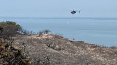
Aerial suppression assets are deployed when ground-based wildland firefighting reaches a rate-of-spread bottleneck. When a vegetation fire breaks out on an isolated landmass like the Isle of Wight, the operational challenge expands beyond basic fuel management and thermal suppression. Island suppression logistics demand a tight balance between local engine company mobilization, cross-water resource transit times, and immediate aerial intervention.
Evaluating an aerial response requires dissecting three core operational phases: thermal containment physics, asset dispatch economics, and wildland-urban interface risk mitigation.
Thermal Containment Physics and Dropline Dynamics
Wildfires advance through three simultaneous heat transfer mechanisms: radiation, convection, and conduction. In dense brush or gorse terrain common to coastal island bluffs, radiant heat preheats adjacent unburned fuels while wind-driven convective plumes carry embers forward, generating spot fires ahead of the primary flame front.
Ground crews operating hose lines face severe physical constraints in steep or unstable terrain. A standard wildland engine crew delivering 50 to 100 gallons per minute through manual lay lines cannot match the heat absorption rate required when flame lengths exceed four feet. At this threshold, direct attack by personnel becomes dangerous and ineffective.
Direct Suppression Equation:
Heat Absorption Required = (Fuel Load x Flame Propagation Velocity) / Heat Capacity of Water
Rotary-wing assets alter this balance by dropping large volumes of water or retardant directly onto the flame line or immediately ahead of the advancing perimeter. A firefighting helicopter equipped with a belly tank or a suspended bucket (such as a Bambi Bucket) introduces several physical variables:
- Drop Velocity and Atomization: Water dropped from too high an altitude atomizes into fine droplets, evaporating before hitting the fuel bed. Dropped too low, the downward rotor wash forces oxygen directly into the base of the fire, intensifying combustion.
- Fuel Penetration: Dense vegetation canopies absorb initial moisture drops, preventing water from reaching the smoldering duff layer below. Flight crews must adjust drop patterns to break through upper canopy layers.
- Cohesion Agents: Pure water drops evaporate rapidly under extreme surface temperatures. Mixing water with short-term retardants or firefighting foams increases viscosity, allowing the liquid to adhere to vertical fuel surfaces and slow radiant ignition.
Aerial Drop Optimization Matrix:
Low Altitude + High Speed   --> Canopy Dispersal (Covers wide area, low penetration)
Low Altitude + Low Speed    --> Soil Penetration (Risk of rotor wash fueling fire)
Optimal Altitude / Speed    --> Base Fuel Saturation without Excessive Atomization
Island Supply Chains and Deployment Bottlenecks
Deploying rotary-wing assets to an island site introduces transit friction that mainland operations rarely encounter. While mainland incidents can reallocate regional assets via continuous highway corridors, island deployment requires specialized staging protocols.
Transit Radius and Fuel Logistics
Helicopters operate under strict flight time limits dictated by fuel capacity and gross weight limits. Carrying a full water bucket significantly increases fuel consumption rates.
- Staging Fuel Supplies: A helicopter operating near a remote coastal fire line rapidly drains internal fuel tanks. If forced to transit back to a mainland airfield for refueling, the operational turnaround time increases from minutes to hours. Tactical efficiency requires establishing localized fuel bowsers near a temporary landing zone (TLZ) on the island.
- Dip Site Proximity: The efficiency of an aerial drop cycle depends on the distance between the target fuel bed and the dip site (a pond, reservoir, or open salt water). A three-minute round trip allows continuous drops that suppress thermal intensity, while a fifteen-minute round trip allows the fire line to re-ignite between drops.
- Corrosive Saltwater Utilization: Dipping into ocean water provides an unlimited supply, but salt water corrodes airframe components and turbine engines. Using seawater requires post-mission engine wash protocols and introduces long-term soil toxicity risks at the drop zone.
Maritime Resource Reallocation
When island ground crews call for mainland reinforcements, transit relies on ferry networks or specialized military lift assets. Moving heavy water tenders, command vehicles, and fresh crews across a sea channel creates a delay window lasting between two to four hours.
During this delay, aerial assets serve as a critical holding mechanism. Their primary objective during early deployment is not full extinguishment, but suppressing fire intensity to allow local ground forces to hold control lines until secondary mainland forces arrive.
The Cost Function of Wildland Suppression Assets
Selecting suppression assets requires matching the economic cost per flight hour against the value of assets protected in the wildland-urban interface (WUI).
| Asset Type | Primary Operational Role | Cruise Speed | Payload Capacity | Key Operational Vulnerability |
|---|---|---|---|---|
| Type 3 Light Helicopter | Reconnaissance, Spot Suppression | High | 100 - 300 Gallons | Low Payload in High Winds |
| Type 1 Heavy Helicopter | Direct Flame Knockdown | Moderate | 700 - 2,000 Gallons | High Downwash, High Cost |
| Fixed-Wing Air Tanker | Long-Line Retardant Drops | High | 1,000 - 3,000+ Gallons | Requires Long Runway, Fixed Dip |
| Ground Wildland Engine | Perimeter Line Construction | Low | 300 - 500 Gallons | Terrain Access Limits |
Light rotary assets offer rapid response times and high maneuverability in restricted airspaces, but lack the mass displacement required to knock down high-intensity canopy fires. Heavy rotary assets deliver high payload volumes, but generate extreme rotor wash that can endanger ground crews working near the drop footprint.
Fixed-wing air tankers carry large loads of long-term retardant, but require established runways for landing and re-arming. On smaller islands, local airstrips often lack the pavement load ratings or runway lengths necessary to support loaded heavy air tankers, forcing reliance on rotary assets that can refill from local bodies of water.
Incident Command and Air-Ground Integration
Directing aerial assets into a chaotic wildland environment requires a strict command structure to prevent mid-air collisions and ensure drop accuracy.
Air Tactical Group Supervisor Protocols
When multiple aircraft operate within a confined fire perimeter, an Air Tactical Group Supervisor (ATGS) coordinates airspace management from a higher altitude. The ATGS sets up operational flight zones:
- The Airspace Flow: Establishing distinct entry, drop, and exit altitudes prevents rotary assets from crossing paths with fixed-wing observation planes.
- Target Designation: Ground operations leaders communicate target coordinates to the flight crew using visual landmarks or GPS grid markers. Ground crews must clear the immediate drop zone to prevent injury from falling debris or the physical impact of thousands of pounds of water.
- Visibility Restrictions: Heavy smoke columns reduce pilot visibility, forcing aircraft to operate higher or abort drops. Thermal imaging cameras mounted on aircraft help crews map the true perimeter through dense smoke layers.
Wind and Microclimate Disturbances
Coastal locations frequently generate localized wind shifts caused by temperature differentials between land and sea surfaces. Sea breezes can suddenly turn a flank fire into a rapidly advancing head fire. Flight crews must continuously monitor local wind patterns to predict drop drift. High crosswinds shear the water column as it leaves the bucket, dispersing the payload over a wide area and reducing its ground impact density.
Strategic Framework for Wildland Risk Mitigation
To minimize the impact of wildland fires in isolated environments, incident commanders must execute a clear strategic playbook based on real-time assessments:
- Establish Immediate Dip Source Protocols: Map all accessible freshwater lakes, agricultural reservoirs, and safe saltwater dip locations within a five-mile radius of high-risk wildland zones prior to ignition events.
- Pre-designate Tactical Landing Zones: Maintain clear, hard-packed sites on the island capable of supporting heavy refueling vehicles and rotary aircraft landings.
- Execute Tiered Air-Ground Mobilization: Deploy light rotary assets immediately for initial line stabilization, followed by heavy ground support transit via maritime routes to secure the perimeter.
- Enforce WUI Defense Defensible Space: Mandate vegetation clearing within 30 to 100 feet of structures along wildland borders to reduce radiant heat transfers and allow ground crews to hold lines without continuous aerial cover.


