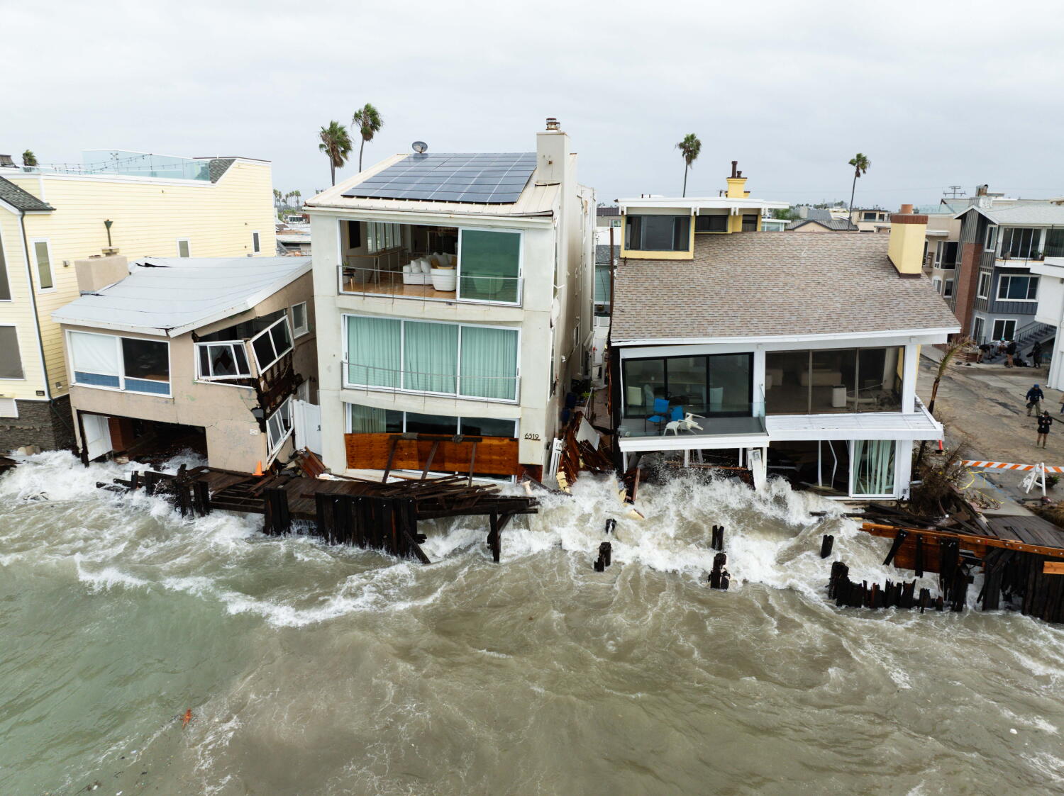
Cooling temperatures and possible rain in Southern California operate as a coupled thermodynamic and hydrologic shift rather than a benign change of season. Standard weather coverage treats cool air and light precipitation as isolated comfort events, missing how a drop in surface heat alters boundary-layer stability, runoff dynamics, road friction, and utility demand across a dense coastal-to-mountain basin. This analysis breaks down the physical mechanisms driving cooling and rain in Southern California, maps where conventional reporting fails, and establishes an operational framework for households, fleet managers, and local operators.
Deconstructing Standard Weather Coverage
Conventional headlines like "Cooler temperatures, possible rain headed for Southern California" compress complex atmospheric transitions into two vague expectations: a jacket-worthy drop in warmth and an ambiguous chance of moisture. That framing leaves readers without the cause-and-effect chain that determines real-world impact. A five-degree drop accompanied by dry onshore flow behaves very differently from cooling driven by an approaching trough, deep marine layer inversion, or frontal passage.
Three structural blind spots weaken typical coverage of Southern California cooling and rain:
- Conflating temperature drop with rain certainty: Air can cool substantially through onshore advection, radiative losses, or upper-level height falls without producing measurable precipitation if mid-level moisture is absent or dry air entrains into ascending parcels.
- Treating "possible rain" as uniform across topography: Precipitation in Southern California is heavily modulated by coastal proximity, the height of the marine inversion, and orographic lift along the Transverse and Peninsular ranges. Coastal basins may see mist or light showers while foothill and mountain slopes capture heavier, rate-driven accumulation.
- Ignoring lag effects after dry spells: Rain following prolonged dry periods interacts with oil residue on pavement, hydrophobic or ash-affected soils on burn scars, and storm-drain sediment in ways that amplify early-event hazards even when total rainfall is modest.
Consider how two commuters interpret "cooler temperatures, possible rain." One assumes a pleasant overcast morning and leaves early on a motorcycle or bicycle without accounting for the first twenty minutes of drizzle mixing with road grime; the other plans outdoor work in an inland valley expecting steady showers that never materialize past the coastal hills. In both cases, vague phrasing obscures the governing mechanism.
The Three-Pillar Physics of Cooling and Rain
Understanding whether a cooling trend in Southern California will remain dry, produce coastal drizzle, or deliver organized rain requires separating three physical pillars: synoptic forcing, boundary-layer structure, and terrain interaction.
Synoptic Forcing and Air Mass Origin
At the synoptic scale, cooling typically reflects either a weakening or eastward shift of high pressure, an approaching upper-level trough, or stronger onshore pressure gradients pulling cooler Pacific air inland. When an upper trough deepens or a frontal boundary approaches, large-scale ascent can cool the air column and transport moisture from offshore or subtropical trajectories. By contrast, a purely coastal pressure gradient increase can cool daytime highs near the shore while leaving interior valleys warm and dry under a ridge.
The distinction between known synoptic observables and educated precipitation hypotheses matters here. Forecasters can observe pressure tendencies, height falls, wind shifts, and satellite moisture plumes with high confidence. Translating those fields into exact rainfall totals at a specific neighborhood remains a conditional hypothesis until mesoscale lift, moisture depth, and convective or stratiform organization align over the target basin.
Boundary-Layer Stability and Marine Layer Depth
Along the Southern California coast, the marine layer acts as a cool, humid surface reservoir capped by warmer, drier air aloft—a temperature inversion that suppresses deep vertical mixing. When the inversion deepens, cool marine air penetrates further into inland valleys and coastal passes, depressing daytime peak temperatures and increasing low-cloud cover.
Cooling and precipitation behave differently depending on how this boundary layer evolves:
- Shallow marine layer: Keeps low clouds and cool air pinned near the immediate coast and beaches, while inland areas warm quickly once morning stratus burns off.
- Deepened marine layer with weak lifting: Spreads cooler temperatures inland and can generate coastal drizzle or light rain out of thick stratus, though total accumulation often stays light.
- Trough-driven column cooling and destabilization: Weakens or erodes the low-level cap, allowing deeper cloud development and more widespread or convective showers across broader zones.
Orographic Lift and Microclimate Divergence
Southern California's geography turns uniform air movement into sharp local contrasts. As moist air encounters coastal bluffs, Santa Monica Mountains, San Gabriel Mountains, San Bernardino Mountains, or Santa Ana and Peninsular ranges, forced ascent cools air parcels adiabatically toward saturation.
This creates a predictable microclimate divergence. A system delivering trace amounts or light showers in a flat coastal basin can trigger steady rain on windward slopes and much drier conditions in rain-shadowed interior pockets. Treating "Southern California" as a single forecast bucket masks elevation and slope effects that govern everything from trail safety to localized debris and runoff risk.
The Impact Function Across Operations and Infrastructure
In operational terms, cooling and rain shift costs and risks across four interconnected domains: thermal load, surface traction, hydrologic response, and schedule reliability. Rather than acting independently, these variables compound when dry intervals precede moisture.
The first operational shift occurs in energy and thermal demand. Cooler temperatures reduce afternoon cooling loads in air-conditioned buildings, easing peak summer-style grid strain, while potentially raising morning heating demand in poorly insulated structures or cool coastal residences. Cloud cover also reduces solar generation output, changing the net balance between daytime generation and load curves.
The second operational shift hits mobility and surface friction. Early light rain or mist on asphalt combines with accumulated motor oil, tire wear, and dust to create slick conditions before sustained runoff washes the surface clean. Reduced visibility from low clouds, coastal fog, or spray compounds braking distance variations across mixed traffic.
The third operational shift governs drainage and terrain stability. Paved urban surfaces convert rainfall into rapid overland flow, testing catch basins and channels where leaves or debris have collected. On steep slopes—especially areas scarred by past wildfire where soil water repellency and loose sediment persist—even moderate rain rates can trigger shallow debris movement or muddy runoff faster than unburned terrain.
The fourth operational shift affects field execution and scheduling. Outdoor construction, logistics, film production, utilities maintenance, and event operations face productivity penalties from wet surfaces, wind shifts, and visibility drops. A forecast that merely says "possible rain" forces teams into binary guessing unless tied to operational thresholds such as wet-surface limits, lightning or wind triggers, and visibility minimums.
A concrete example illustrates the chain reaction. Suppose a property or facilities manager oversees a commercial site with flat roofs, storm drains, and outdoor loading bays after weeks of dry weather. If cooling arrives ahead of scattered showers, clogged scuppers and uninspected drains turn minor rooftop or yard ponding into interior leaks or slip hazards, even when regional rainfall totals look unimpressive on paper.
Step-by-Step Operational Playbook
Because exact rainfall amounts and timing carry inherent uncertainty prior to system arrival, high-performing operators use a staged decision workflow keyed to observable triggers rather than headline adjectives.
- Audit the driver before adjusting plans. Check whether cooling stems from onshore flow/marine layer deepening or an approaching trough/frontal system, and note how far inland the forecast pushes cool air and cloud cover.
- Map assets to microclimate zones. Separate coastal, basin, foothill/mountain, and inland valley locations so resources are not over-allocated to dry rain-shadow zones or under-allocated to orographic slopes.
- Clear hydrologic chokepoints prior to moisture. Inspect storm drains, gutters, trenches, and staging pads while conditions are still dry, prioritizing areas near slopes, burn scars, or high pedestrian and vehicle throughput.
- Set explicit threshold triggers for field and transit operations. Define exact conditions—such as measurable rain onset, slick pavement during the first hour of wetting, wind gusts, or low-visibility ceilings—that automatically shift outdoor tasks indoors or extend travel buffers.
- Re-evaluate during the transition window. Update schedules as radar, surface stations, and satellite trends confirm whether moisture is over-performing or under-performing model expectations, rather than locking into a static plan made days earlier.
Limitations and Forecasting Blind Spots
No analytical framework eliminates meteorological uncertainty. Short-range precipitation forecasts in complex coastal-mountain terrain remain sensitive to small shifts in trough position, moisture plume width, inversion height, and convective cell placement. A slight displacement in track can turn a soaking rain event into scattered showers—or push moisture just north or south of a target corridor.
Operational plans also face limits from baseline infrastructure conditions and human lag. Even the most accurate weather briefing cannot instantly clear years of accumulated sediment or overcome deferred maintenance on aging drainage systems. Likewise, over-reacting to every low-probability shower with full operational shutdowns creates unnecessary downtime and alert fatigue, eroding credibility when high-impact weather actually arrives.
The strategic move for decision-makers is to replace vague weather watching with trigger-based readiness: pre-clear drainage and check high-friction or slope-adjacent zones ahead of any incoming cool, moist pattern, tie field and commute adjustments to confirmed onset and microclimate exposure rather than headline probabilities, and treat every early wetting event as a high-friction surface test until proven otherwise.